


 24/7 Emergency Service
Heavy Rain and Snow Storm Watch Cleveland, Ohio
2/23/2016 (Permalink)
 https://www.facebook.com/ScottSabolFanPage/?fref=nf
Mark Johnson https://www.facebook.com/MarkJohnsonWeather/?fref=photo said" WINTER STORM UPDATE: Right now, Heavy Rain is expected Wednesday transitioning to a heavy, wet snow by Thursday morning. Turing colder Thursday. Exact storm track still unknown, but right now, it appears the surface low pressure wants to track right up I-71. That means 40s & rain Wednesday followed by a few inches snow Thursday. Stay tuned."
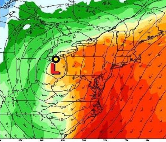
Scott Sabol https://www.facebook.com/ScottSabolFanPage/?fref=ts said " Yet another southern storm (remember our winter outlook which highlighted these back last year). This one will track further WEST across Ohio late Wednesday. HOWEVER, its still a bit too early in determining whether or not this will change back east. The position of the two lows reflected in the upper levels (right most box on the graphic below) have bounced back and forth over the last 24 hours. Eventually, one will win out. So as of this writing, our forecast is for RAIN and WIND (40s) on Wednesday with a changeover early Thursday to wet snow. Initial snowfall forecast is for 1-3" region wide Thursday. More changes ahead...stay tuned."
Check out http://www.wkyc.com/weather for current radar maps.
Remember: SERVPRO of Beachwood, Shaker Heights, Cleveland Heights and SERVPRO of South Euclid/Lyndhurst/Pepper Pike can be reached at 216-464-4498 if you find a pipe burst, your hot water tank broke or some other source caused a flood in your home.